Posts

Posts mit dem Label "MapBox" werden angezeigt.

Tutorial: Creating maps from geo tagged photos

Bild
If your camera is able to add gps coordinates to the photos you can use darktable to create a KML or geoJSON files with thumbnails of the photos. Install the latest version of darktable: https://www.darktable.org/install/ Get the latest version of the KML or geoJSON script: https://github.com/darktable-org/lua-scripts/tree/master/contrib Copy the scripst into the folder: ~/.config/darktable/lua Add this lines to the file: ~/.config/darktable/luarc require "kml_export" r equire "geoJSON_export" Import the photos into darktable: https://www.darktable.org/usermanual/ch01s03.html.php#d0e788 Edit the settings: Select all photos you like to have in the KML or JSON file. Export the photos:   And this are the results of the exports The KMZ opened in Google Earth The KMZ opened in KDE Marble The HTML file, that renders the geoJSON with the help of MapBox .  (To get the map rendered you need a MapBox account and insert the ...
Maps for Photo Books

Bild
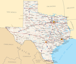
  I love to add maps to the photo books. Here is a collection of some of them.    This is a example of a simple map without the visited places marked. I just added the big Texas label and the overview map of North-America. I used Inkscape and Gimp for this map.    This is a map I made as a title for a calender. I marked the locations from the photos. This image was made with Inkscape. This map is a mix of elements with Gimp extracted from old maps and then composed to a new map in Inkscape.  For this map I got the base image from Mapbox . Then I added the route and some details with Inkscape. To create the route I used Google My Maps , exported it as KML file and converted it to SVG. Here I used a image from the NASA and added the flight route with Gimp and the text boxes with Inkscape. Here I used Blender to create the map. I wrote a longer post here: Low polygon 3D europe map Google My Maps and Inksc...