Posts

Posts mit dem Label "NASA" werden angezeigt.

Expiriments with A-Frame

Bild
Moon with displacement map I played again a little bit with A-FRAME to create the moon. Thanks go to CG BOOST for giving me the link to the NASA image and displacement map from the moon and to the Museum of Science in Boston hat created the nice 360° star background . https://github.com/supertobi/aframe-moon-with-displacement-map Earth with moon But the Moon was not enough. I created a earth and now the moon is rotating around the earth: If you have a VR headset please use it! The earth and cloud textures are again from the NASA and then improved with GIMP.   https://github.com/supertobi/aframe-earth-with-moon Matterhorn Then even closer to the ground I made a 3D piece from the Alps with the Matterhorn. I was inspirited by @Taky_ed Matterhorn, I used GIMP for editing the textures, A-FRAME for displaying and the stars background from Museum of Science in Boston .   https://github.com/supertobi/A-FrameMatterhorn

Howto open Elevation data from NOAA GLOBE in GIMP

Bild
Download the GLOBE elevation tiles from here:  https://www.ngdc.noaa.gov/mgg/topo/gltiles.html Unzip the file Rename the file to *.data Start GIMP and open the file. This dialogue will appear:  Now use the Colors->Levels Tool to make the data more useable:

Gimp now supports the HGT file format

Bild
In the latest developer version Gimp (2.9.8) now supports the HGT file format. So what is HGT? That’s topography data basically just containing elevation in meters of various landscape ( HGT stands for “ height “), gathered by the Shuttle Radar Topography Mission (SRTM) run by various space agencies (NASA, National Geospatial-Intelligence Agency, German and Italian space agencies…).  You can read more about the file format in Jehans blog: https://girinstud.io/news/2017/12/new-format-in-gimp-hgt/ Get Gimp >= 2.9.8. Get the HGT file you are interested in. I used this on: https://dds.cr.usgs.gov/srtm/version2_1/SRTM3/Eurasia/N50E014.hgt.zip Unzip the file. Open the HGT file in Gimp.  It is OK, that the file is all gray. Now we have to go to the next step. Edit the HGT file with Colours -> Levels Use the black and white triangles in the "Input Levels" section to show only the interesting data. To be more exact you can open the levels dialogue a second t...

Low polygon 3D Europe map UPDATE 2

Bild
As the "Low polygon 3D Europe map" tutorial is on of the most read posts I have some more information for you.   1. Here you can download a complete land topography of the world as a digital image of the three-dimensional structure of the Earth's surface: http://visibleearth.nasa.gov/view.php?id=73934  2. The link to "Open Digital Elevation Model (OpenDEM)". You can use this data to create an similar image. (I haven't done this. It looks like a lot of work.) http://www.opendem.info/index.html 3. Somegeneral information about Digital elevation models: https://en.wikipedia.org/wiki/Digital_elevation_model The two older post in this series:  Low polygon 3D Europe map Low polygon 3D europe map UPDATE

Maps for Photo Books

Bild
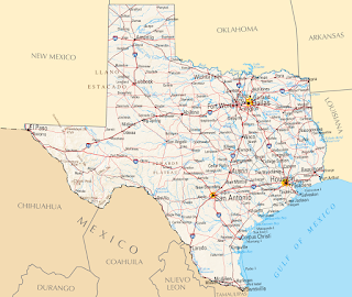
  I love to add maps to the photo books. Here is a collection of some of them.    This is a example of a simple map without the visited places marked. I just added the big Texas label and the overview map of North-America. I used Inkscape and Gimp for this map.    This is a map I made as a title for a calender. I marked the locations from the photos. This image was made with Inkscape. This map is a mix of elements with Gimp extracted from old maps and then composed to a new map in Inkscape.  For this map I got the base image from Mapbox . Then I added the route and some details with Inkscape. To create the route I used Google My Maps , exported it as KML file and converted it to SVG. Here I used a image from the NASA and added the flight route with Gimp and the text boxes with Inkscape. Here I used Blender to create the map. I wrote a longer post here: Low polygon 3D europe map Google My Maps and Inksc...