Maps for Photo Books
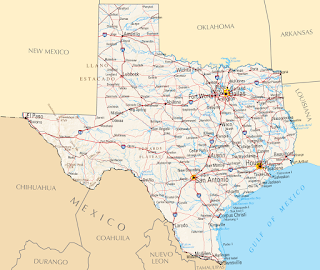
I love to add maps to the photo books. Here is a collection of some of them. This is a example of a simple map without the visited places marked. I just added the big Texas label and the overview map of North-America. I used Inkscape and Gimp for this map. This is a map I made as a title for a calender. I marked the locations from the photos. This image was made with Inkscape. This map is a mix of elements with Gimp extracted from old maps and then composed to a new map in Inkscape. For this map I got the base image from Mapbox . Then I added the route and some details with Inkscape. To create the route I used Google My Maps , exported it as KML file and converted it to SVG. Here I used a image from the NASA and added the flight route with Gimp and the text boxes with Inkscape. Here I used Blender to create the map. I wrote a longer post here: Low polygon 3D europe map Google My Maps and Inksc...